| No snowmobiles, please. |
 |  | |
 |  |
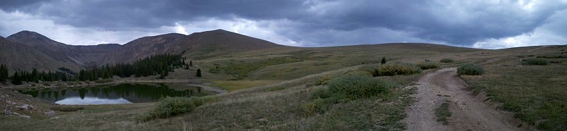
 click for full size right click to save |
 click for full size right click to save |
 click for full size right click to save |
 click for full size right click to save |
Waypoints from Parking to the Yurts
back to topAll waypoints are in Degrees, Minutes, Seconds. The waypoints are shown on the maps to the right.
| Waypoint | North | West | |
| 000 | 39,13,28 | 106,14,34 | This is the trailhead parking |
| 001 | 39,13,30 | 106,14,10 | |
| 002 | 39,13,21 | 106,14,37 | |
| 003 | 39,13,10 | 106,14,50 | |
| 004 | 39,12,58 | 106,14,51 | |
| 005 | 39,12,48 | 106,14,54 | |
| 006 | 39,12,31 | 106,15,70 | |
| 007 | 39,12,30 | 106,15,13 | |
| 008 | 39,11,53 | 106,14,48 | |
| 009 | 39,12,22 | 106,13,48 | |
| 010 | 39,12,18 | 106,13,20 | |
| 011 | 39,12,10 | 106,13,18 | |
| 012 | 39,12,30 | 106,13,21 | |
| LBY | 39,12,50 | 106,13,31 | This is the yurt location |
GPS track from Harrison Avenue, Leadville to the Yurts
Track files starting from Harrison Avenue (at the Conoco) to the Yurts and back are available in GPX and KML files. There are also waypoint files in both GPX and KML formats. The GPX files can be imported to may GPS devices. The KML files are Google Earth files.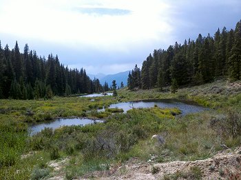 | | |
| |
Right click on the links below to save the files to your computer. Click on the KML files to open them with Google Earth.